The least useful thing to read at the moment your phone starts shrieking in a Japanese hotel room is an article telling you to stay calm. This one covers three specific things instead. First: on 29 May 2026 Japan renamed its entire disaster-prevention weather information system — eight emergency warnings, four newly created Danger Warnings, eight warnings and seventeen advisories, every relevant name now prefixed with its warning level number. The words on the screen no longer match what the guides say, including the sediment-disaster term that appears in nearly all of them and is no longer on the official list at all. Second: what the Japan Meteorological Agency actually wrote, line by line, about the first minute of an earthquake — one sentence of which flatly contradicts the advice most visitors arrive with. Third: whether the phone in your pocket, running on roaming or a travel eSIM, will receive an Earthquake Early Warning at all. The honest answer is that no agency has said, and knowing that it is unverified is worth considerably more than being reassured by someone who never checked.
- Every warning name changed on 29 May 2026 (MLIT announcement, 14 April 2026). Names now carry a warning level number, and a new Level 4 "Danger Warning" tier was created. The old sediment disaster alert term is gone
- Do not run outside. The JMA location guide says to protect your head and shelter under a sturdy desk, and in the same breath, not to rush outside in a panic
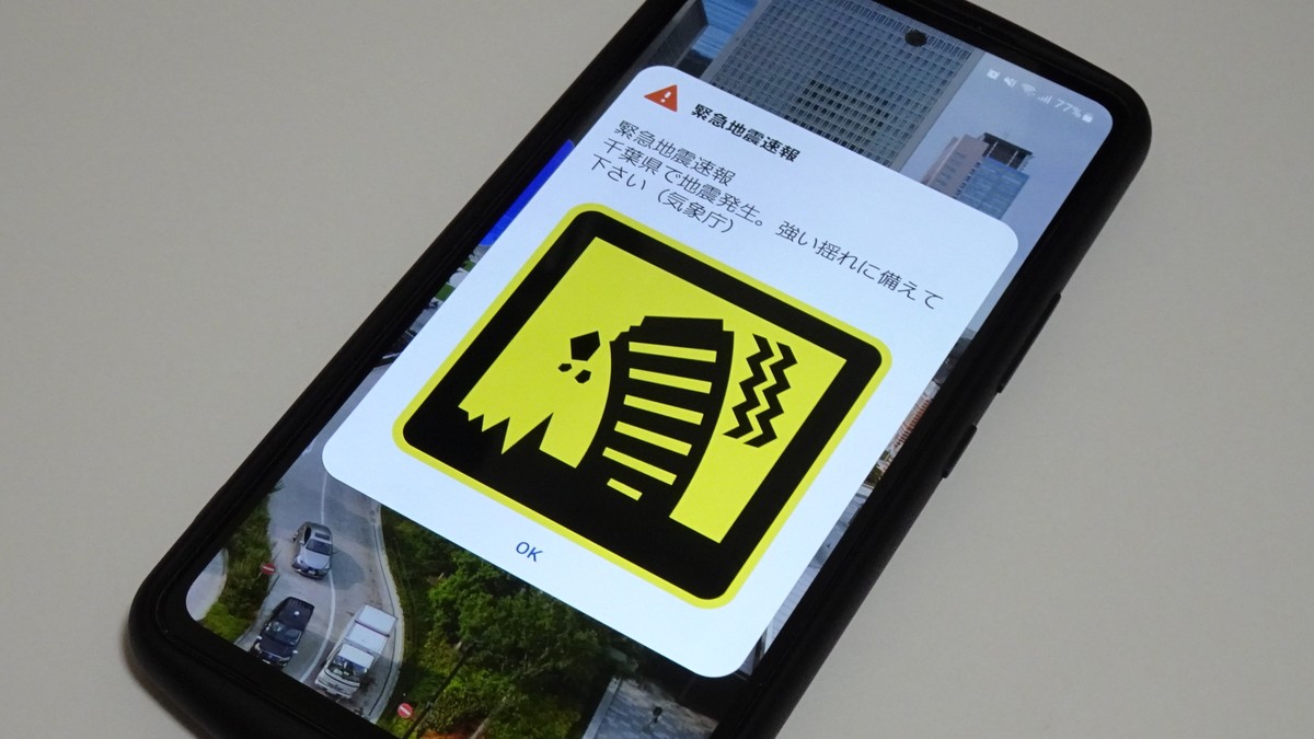
- Whether your phone alerts is officially unspecified. JMA refers the question to the carriers; Docomo says handsets it did not sell are not operationally verified and may not work. Buying an eSIM does not make you receive Earthquake Early Warnings
- Install Safety tips instead — supervised by the Japan Tourism Agency, 15 languages, push notifications for earthquake early warnings, tsunami warnings and weather emergency warnings over the data network
- Save one number: Japan Visitor Hotline 050-3816-2787, 24 hours a day all year, English, Chinese and Korean, for accidents, illness and disasters
Table of Contents
- The first minute of an earthquake
- Will your phone actually alert?
- 29 May 2026: everything got renamed
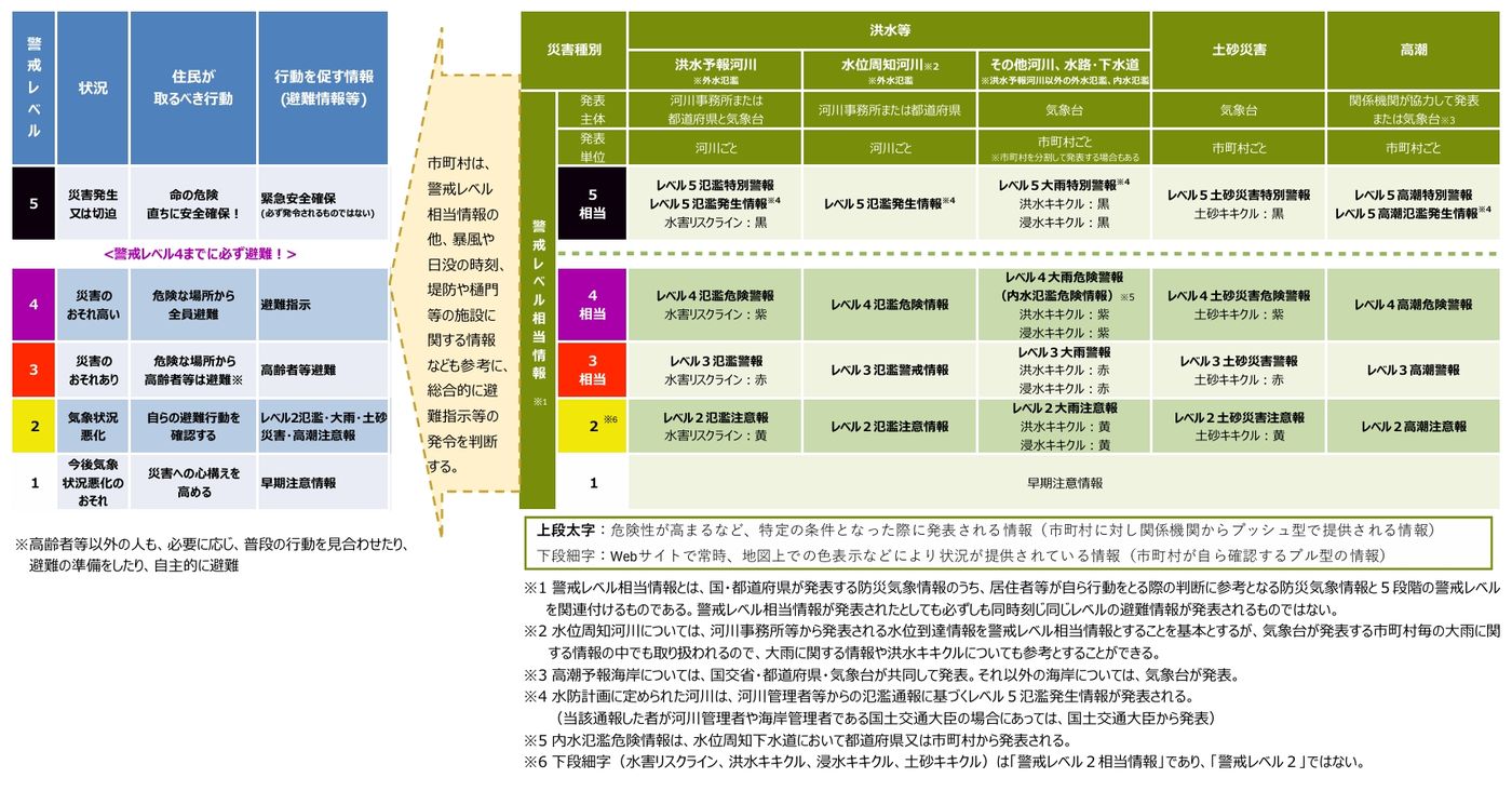
- Warning levels 1 to 5
- Tsunami: three tiers, two actions
- Typhoons: the forecast circle is not the storm
- Evacuation site is not the same as shelter
- Nankai Trough extra information
- Summer heat: the alert nobody tells visitors about
- Where the information comes from
- A five-minute pre-departure checklist
- Frequently Asked Questions
The first minute of an earthquake
Start with the sound. The alert tone on Japanese handsets is not a design choice by each carrier — the JMA states in its FAQ that it strongly recommends the NHK chime for the purpose, which is why the noise coming out of a hotel corridor, a station concourse and a convenience store is the same noise. Hear it once and you will recognise it.
Now the part that matters. Everything in the table below comes from the JMA page on what to do when you see or hear an Earthquake Early Warning. It is transcription and translation, not advice of ours:
| Where you are | JMA guidance (original) | In English |
|---|---|---|
| At home / hotel room | 頭を保護し、丈夫な机の下など安全な場所に避難してください/あわてて外に飛び出さないでください/無理に火を消そうとしないでください | Protect your head and take shelter somewhere safe such as under a sturdy desk. Do not rush outside in a panic. Do not force yourself to put out a fire |
| Crowded buildings (department stores, stations, theatres) | 施設職員の指示に従う/落ち着いて行動し、あわてて出口には走り出さないでください | Follow the instructions of facility staff, act calmly, and do not run for the exits |
| Outdoors, on the street | ブロック塀の倒壊に注意/看板や割れたガラスの落下に注意してください | Beware of collapsing concrete-block walls and of falling signage and broken glass; take shelter in a solid building |
| Driving | 急ブレーキはかけず、緩やかに速度をおとしてください | Do not brake hard; reduce speed gently |
| On a train or bus | つり革や手すりをしっかり掴む | Hold firmly to a strap or handrail |
| In a lift | 最寄りの階で停止させて、すぐに降りてください | Stop at the nearest floor and get out immediately |
| In the mountains or near a cliff | 落石やがけ崩れに注意してください | Beware of falling rocks and landslides |
The overarching principle in the same document is to respond to your surroundings without panic and secure your own safety first. Two widely circulated pieces of advice are contradicted outright by the text above:
- "Get outside, into an open space." The home entry says, in the same passage, not to rush outside in a panic; the crowded-building entry says not to run for the exits. Both halves of that guidance belong together and the second half is the one that gets dropped.
- "Turn off the gas first." The official line is not to force yourself to put out a fire. Protect your body; deal with the fire afterwards.
How long does this last? The JMA FAQ says to stay alert and protect yourself for about one minute from the moment you see or hear the warning, and notes that strong shaking generally lasts at most about a minute.
How the warning works, and its three hard limits
The physics is simple. An earthquake sends out a fast, relatively harmless P wave first — the JMA gives roughly 7 km per second — followed by the slower, damaging S wave at roughly 4 km per second. Using seismometers at around 690 JMA sites plus about 1,000 belonging to the National Research Institute for Earth Science and Disaster Resilience, the agency detects the P wave and completes analysis and transmission in a matter of seconds, pushing the warning ahead of the S wave.
The warning threshold: it is issued when a maximum seismic intensity of 5-lower or above, or a long-period ground motion class of 3 or above, is forecast, and it targets areas where intensity 4 or above (or long-period class 3 or above) is expected. There is also a lower-threshold forecast tier, triggered at wave amplitudes of 100 gal or more, magnitude 3.5 or above, or a maximum predicted intensity of 3 and long-period class 1. A single earthquake typically produces several bulletins — the JMA says roughly five to ten — so a rapid series of alerts does not mean a series of earthquakes. As for the emergency-warning tier, it corresponds to forecasts of intensity 6-lower or above, or long-period class 4, but in practice it is not issued distinctly from the ordinary warning.
Three limitations, all from the JMA page on the characteristics of Earthquake Early Warnings:
- The lead time is tiny — described as extremely short, from a few seconds to at most a few tens of seconds.
- Near the epicentre it cannot work. For shallow inland earthquakes the agency writes that delivering the warning to locations near the epicentre before the strong shaking arrives is impossible in principle. So the belief that the alert always precedes the shaking is simply wrong — Docomo says the same thing in its own service notes, that reception before you feel the shaking is not guaranteed.
- The intensity forecast carries error, described as roughly plus or minus one intensity class.
That third point explains something visitors often misread. When a department store announcement says only that strong shaking is possible, without a number, that is not a shortage of information — it is the announcement following official guidance. The JMA advises operators of crowded facilities not to broadcast specific predicted intensities or lead times, precisely because early bulletins carry that error.
Seismic intensity has ten levels, not seven
The JMA shindo scale runs 0, 1, 2, 3, 4, 5-lower, 5-upper, 6-lower, 6-upper, 7 — ten steps, because 5 and 6 are each split. A news report saying "intensity 5-upper" is describing something meaningfully worse than 5-lower, and any source that flattens them into "a 5" has lost information. Note too that intensity describes how hard a given place shook, while magnitude describes the energy of the earthquake itself. One earthquake has one magnitude and as many intensities as there are places.
Will your phone actually alert?
This is the question the rest of the internet answers with more confidence than the sources allow, so here it is properly.
Start with the JMA. Its page on receiving Earthquake Early Warnings names the five carriers that broadcast them to handsets: NTT Docomo, au, SoftBank, Y!mobile and Rakuten Mobile. On the question of whether your particular phone will receive them, the agency writes that for details of compatible handsets and the settings required, you should contact the mobile phone companies. Reading that page and the earthquake FAQ in full turns up nothing whatsoever about foreign SIMs, international roaming or overseas eSIMs.
So look at the carriers. Docomo is the one with published wording:
- On handsets it did not sell: Area Mail on models outside its compatible list has not been operationally verified and may not be usable, and Docomo adds that it cannot answer questions about whether it works or how to operate it.
- On unlocked Android phones carrying another carrier SIM: from Android 8.1 the specification allows the other carrier emergency mail to be received, but Docomo does not guarantee reception or behaviour. Below 8.1 it states reception is not possible.
- Other limits: a missed Area Mail cannot be re-delivered, and nothing arrives if the handset is off, in aeroplane mode, or somewhere with poor signal.
Mechanically, these mass alerts travel by cell broadcast (ETWS). A March 2024 Ministry of Internal Affairs and Communications document explains that the common Android reception specification exists so that when a SIM is inserted, warnings can be received on that SIM contract holder network — meaning delivery is tied to whether the SIM and the network you are on correspond. One honest caveat: that document concerns domestic roaming between Japanese carriers, the arrangement used when one operator has an outage, not international roaming. It cannot be used to conclude that foreign numbers do or do not receive alerts; it can only illustrate that ETWS delivery depends on that pairing.
What to do instead: Safety tips, 15 languages
Since whether the handset rings is a variable you cannot verify, load up on the parts you can control. Safety tips is the official disaster app for inbound visitors, and two details are worth stating precisely, because I got one of them wrong in an older article. It is supervised by the Japan Tourism Agency — the distribution page carries a Japan Tourism Agency copyright line — and it is not the JNTO general travel app. What it delivers, per the official description, is push notification of Earthquake Early Warnings, tsunami warnings and weather emergency warnings.
The listed languages number fifteen: English, Japanese, Korean, Traditional Chinese, Simplified Chinese, Vietnamese, Spanish, Portuguese, Thai, Indonesian, Tagalog, Nepali, Khmer, Burmese and Mongolian. Three of its functions exist specifically for people who cannot read the surrounding signage: an evacuation flowchart showing actions to take in light of the circumstances, a set of phrases for obtaining information from people around you, and a collection of official links for use during a disaster. The requirements on the official page read iOS 9.0 or later and Android 5.0 or later — figures old enough that the page may simply not have been updated, so treat them as what the page records rather than as a selling point.
This is one of the few places in this article where an opinion is safe, so here it is: install it before you fly. Not because the interface is lovely, but because downloading an app is the single thing you absolutely cannot do at the moment you need it. When the ground is moving or the network is congested, the app store is the last place you want to be. For the rest of what belongs on your phone — maps, IC cards, translation, booking — see our guide to the Japan travel apps worth installing; disaster alerts are handled here.
J-ALERT, and the myth about televisions
According to the Fire and Disaster Management Agency, J-ALERT transmits information with almost no margin for response — ballistic missile alerts, Earthquake Early Warnings, Major Tsunami Warnings — by satellite and landline to every prefecture and municipality in the country, automatically activating municipal disaster-prevention radio to relay it instantly. The originating bodies are the Cabinet Secretariat for civil protection information and the JMA for earthquakes, tsunami, eruptions and weather emergency warnings. The route to your handset is the emergency mail described above.
The often-repeated claim that a television will switch itself on to broadcast an earthquake alert is not true. The JMA FAQ states plainly that televisions and radios do not switch on automatically for this. The system that does wake a standby receiver is the Emergency Warning Broadcast, which runs for events such as tsunami warnings — and specifically not for Earthquake Early Warnings.
29 May 2026: everything got renamed
This is the most time-sensitive section here. The MLIT press release of 14 April 2026 announced in its own headline that new disaster-prevention weather information would begin operating on Friday 29 May 2026, with level numbers attached to the information names; the switchover began around 13:00 on 28 May. The JMA had trailed the change in a release on 16 December 2025 covering the level-number prefixes, the creation of the Danger Warning tier at Level 4, the new Level 5 Flooding Emergency Warning, and two new products for rapid bulletins and commentary.
The practical effect on a visitor is blunt: the words on your screen no longer match what the guides say. Old names on the left, current names on the right:
| The old name still in circulation | Current name since 29 May 2026 | Level |
|---|---|---|
| Sediment disaster alert information(土砂災害警戒情報) | レベル4土砂災害危険警報 Level 4 Sediment Disaster Danger Warning (new tier) | 4 |
| Flood danger information(氾濫危険情報) | レベル4氾濫危険警報 Level 4 Flooding Danger Warning (new) | 4 |
| (no predecessor — newly created) | レベル4大雨危険警報 / レベル4高潮危険警報 | 4 |
| Heavy rain warning(大雨警報) | レベル3大雨警報 Level 3 Heavy Rain Warning | 3 |
| Flood warning(洪水警報) | レベル3氾濫警報 Level 3 Flooding Warning | 3 |
| Heavy rain emergency warning(大雨特別警報) | レベル5大雨特別警報 | 5 |
| (no predecessor — newly created) | レベル5氾濫特別警報 | 5 |
| Heavy rain advisory(大雨注意報) | レベル2大雨注意報 | 2 |
The full set, per the current JMA page listing warning and advisory types:
- Emergency warnings, 8 types: Level 5 flooding, heavy rain, sediment disaster and storm surge emergency warnings, plus heavy snow, storm, snowstorm and high wave emergency warnings. The threshold for those last four is described as once in several decades.
- Danger warnings, 4 types (new): Level 4 flooding, heavy rain, sediment disaster and storm surge danger warnings, defined as forecasts issued to warn of a dangerous situation in which the likelihood of serious disaster is high.
- Warnings, 8 types: Level 3 flooding, heavy rain, sediment disaster and storm surge warnings, plus heavy snow, storm, snowstorm and high wave warnings.
- Advisories, 17 types: Level 2 flooding, heavy rain, sediment disaster and storm surge, plus heavy snow, strong wind, wind and snow, high waves, thunder, dense fog, dry air, avalanche, ice accretion, snow accretion, snowmelt, frost and low temperature.
Notice what does not carry a number: snow, storm and high wave products keep their old names, because they do not map onto the five-stage evacuation framework. For a traveller that distinction is useful shorthand — a name with a level number is telling you about evacuation, while one without (a heavy snow warning, a storm warning) is telling you about transport and whether your plans survive the day. For when and where snow starts falling, see our guide to first snowfall across Japan.
One more misread worth correcting: a warning does not mean the disaster has begun. The JMA issues warnings when a qualifying phenomenon is forecast roughly three to six hours ahead. When one lands, you usually still have hours to move, change plans or get back to your accommodation.
Warning levels 1 to 5
Each level maps to one named action. The JMA Kikikuru risk-distribution maps use colours for the same scale, so those are included:
| Level | Corresponding information | Kikikuru colour | Action required |
|---|---|---|---|
| 5 | Emergency warning | Black — disaster imminent | Secure safety by any means available |
| 4 | Danger warning (new tier) | Purple — danger | Evacuation instruction |
| 3 | Warning | Red — alert | Evacuation of older adults and others needing time |
| 2 | Advisory | Yellow — caution | Check evacuation destination and route on a hazard map |
| 1 | Early notice information | — | Raise your awareness |
A term to strike from your notes: hinan kankoku, the "evacuation advisory", was abolished. Since the amended law took effect on 20 May 2021 it has been merged into the evacuation instruction, leaving three evacuation notices — the Level 3, Level 4 and Level 5 actions in the table. Any guide still telling you to move when an evacuation advisory is issued is at least five years stale. The Cabinet Office guideline on evacuation information was itself revised in March 2026, and cites alignment with the new weather information system as a reason.
Tsunami: three tiers, two actions
This section is pure transcription, because it is the one with the worst consequences for getting it wrong. Per the JMA tsunami warning page:
| Type | Criterion (forecast maximum wave height) | Announced height bands | JMA action guidance |
|---|---|---|---|
| Major Tsunami Warning | Exceeding 3m at the highest points | over 10m / 10m / 5m | Evacuate immediately to high ground or an evacuation building |
| Tsunami Warning | Above 1m and up to 3m | 3m / 1m | |
| Tsunami Advisory | 0.2m up to 1m | — | Get out of the water and move away from the shore |
Three things to carry. The JMA classifies the Major Tsunami Warning as an emergency warning. The agency targets the first bulletin within about three minutes of the earthquake, about two minutes for some events. And for a very large earthquake the first bulletin may carry no numbers at all, using the words kyodai (enormous) and takai (high) in place of a height — which is the agency saying it cannot yet quantify the wave and the situation is serious.
The point that must not be smoothed over: the warning tiers and the advisory carry different official instructions. Warnings say go to high ground; the advisory says leave the water and the shoreline. Those are not interchangeable, and neither should be compressed into a general instruction to head uphill.
Typhoons: the forecast circle is not the storm
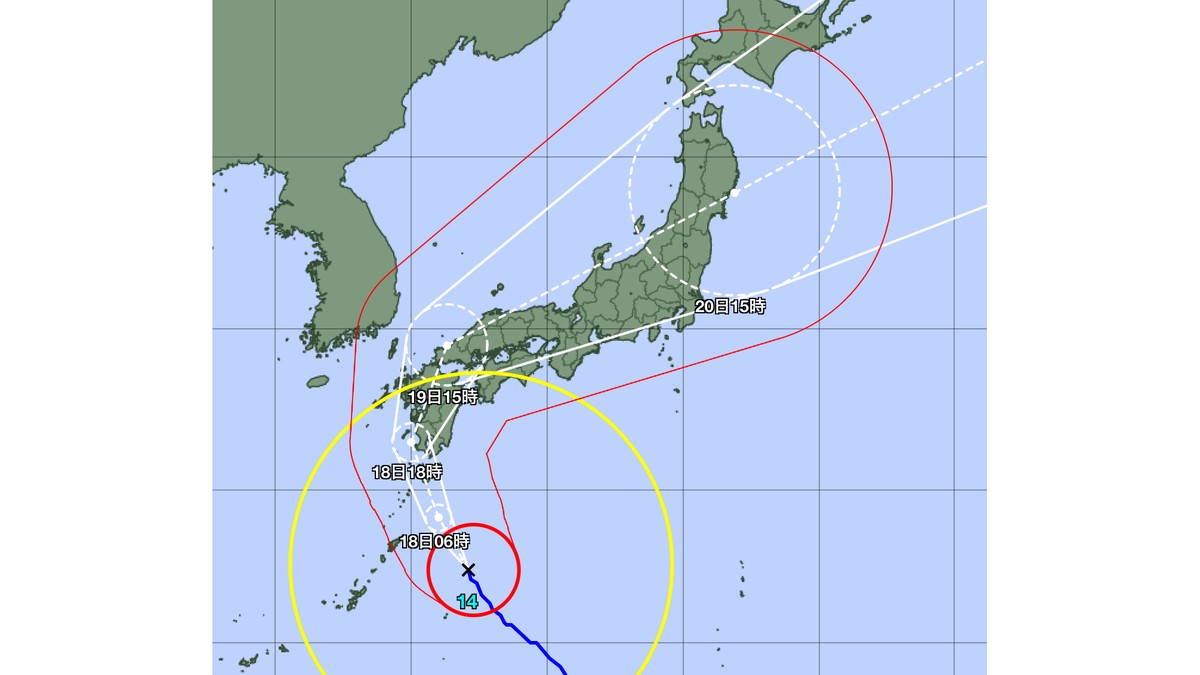
The single most misread graphic in Japanese typhoon coverage is the track map. Per the JMA explainer:
- The forecast circle means there is a 70% probability that the typhoon centre lies within that circle at the forecast time. It represents positional uncertainty and has nothing to do with the size of the storm. So the circle touching your city does not mean your city gets hit by gales.
- The storm area is where winds reach 25 m/s or more, drawn as a thick red line.
- The strong wind area is 15 m/s or more, drawn in yellow.
- The storm warning area is the full extent that may enter the storm area within five days (120 hours).
What you actually want to know is whether that red circle sweeps over you, and whether your destination has a Level 3 storm warning in force.
Why trains stop before anything happens
Japanese railways run planned suspensions, announcing service cancellations ahead of the weather rather than during it. JR West describes its own rhythm in its published explainer: it gathers weather information in advance to judge whether to suspend, and indicates the possibility of a planned suspension roughly two days before, deciding whether to implement it one day before. The same document notes that services may be thinned before a full suspension, and that where suspensions are wide-ranging, restoring the normal timetable can take time — which is the trap that catches most visitors. The typhoon passing does not mean tomorrow runs normally.
Airlines: no general rule is offered here
When a typhoon approaches, airlines typically open a weather investigation covering flights that may be affected and publish the list of qualifying services, waiving change or refund fees where the conditions are met. But the trigger conditions, how affected flights are identified and how far you may rebook differ by carrier, and the official terms from ANA and JAL could not be retrieved for this article (the ANA page renders via JavaScript; the JAL page returns 403). So no carrier-specific day counts or conditions appear here — inventing them would be worse than omitting them. There is only one reliable procedure: open your own airline official notice page and check whether your flight number is on the list. For whether delays and cancellations can be claimed, what the trip-disruption thresholds are and which receipts to keep, see our Japan travel insurance guide.
Evacuation site is not the same as shelter
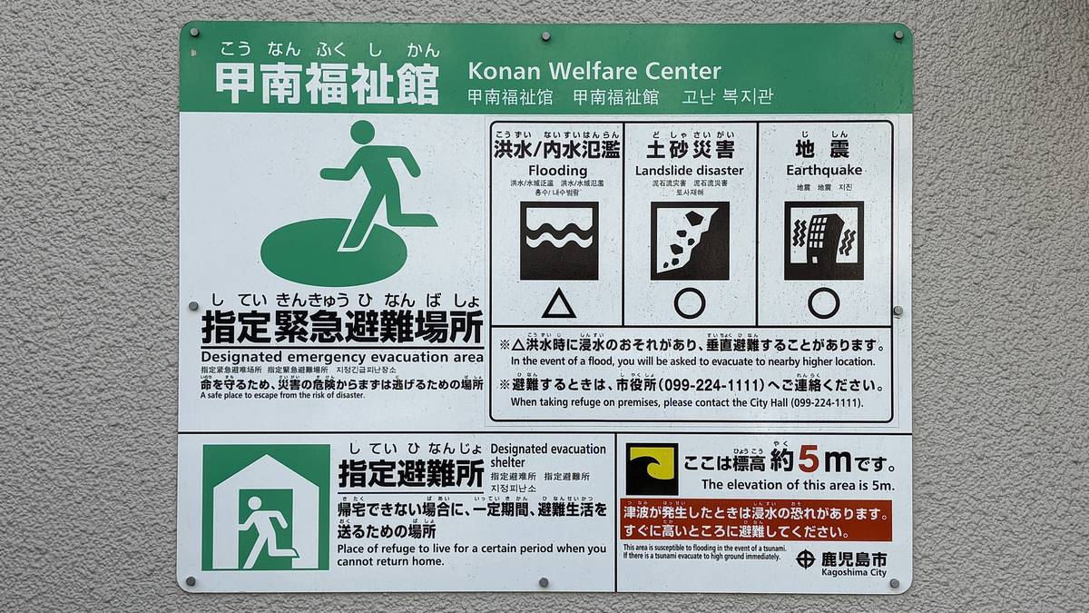
English collapses two legally distinct things into one word, and the difference is not academic:
| Designated emergency evacuation site | Designated shelter | |
|---|---|---|
| Legal basis | Basic Act on Disaster Management, Art. 49-4 | Basic Act on Disaster Management, Art. 49-7 |
| Definition | Somewhere you evacuate to urgently, to protect your life from the hazard | A facility where displaced people stay for a period |
| How designated | By the municipal mayor, separately for each hazard type (flooding, landslide and debris flow, earthquake, tsunami, large-scale fire and so on) | By the municipal mayor, without reference to hazard type |
| What it means for you | Where you go during the event | Where you may end up if you cannot get back to your hotel |
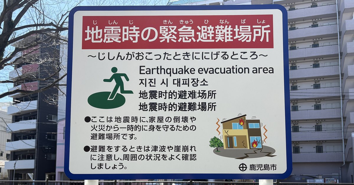
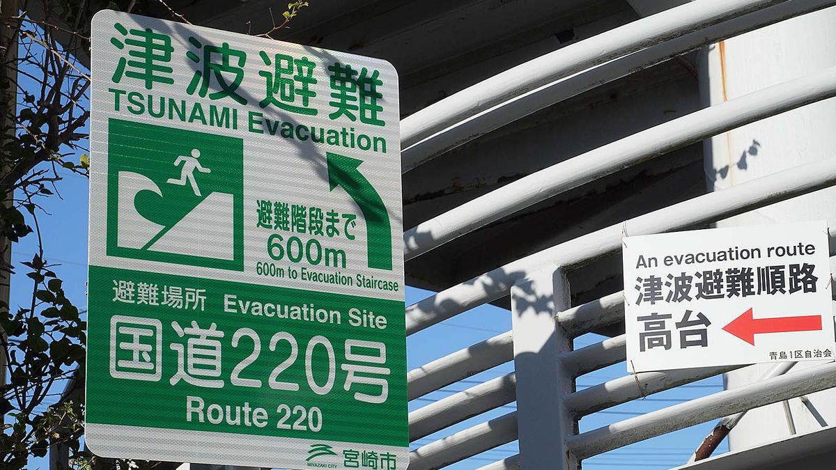
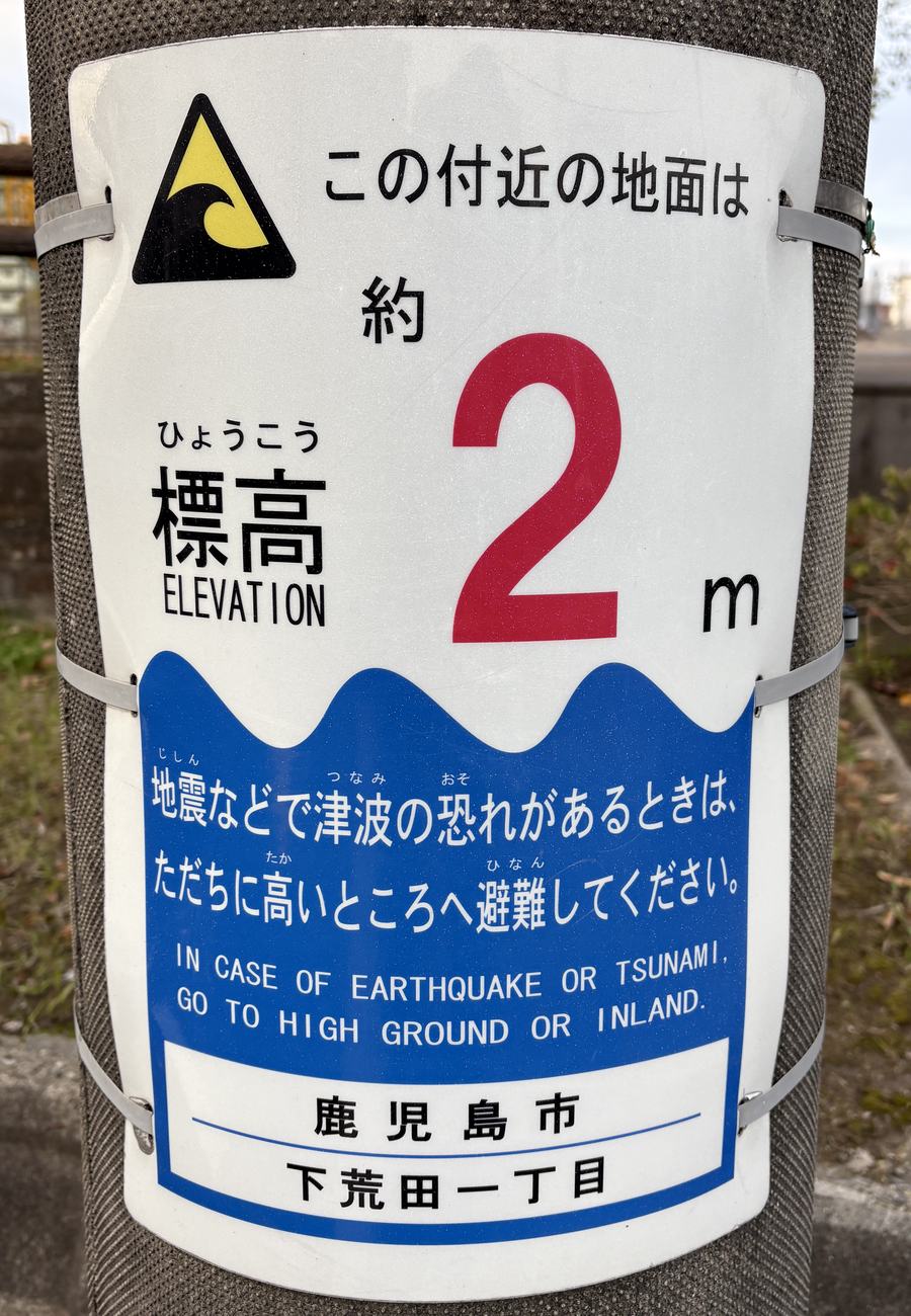
A single site can legally be both, and often is. But the phrase that matters is "separately for each hazard type": a location designated as an evacuation site for earthquakes is not automatically valid for tsunami. That is exactly the information the icons on the signboard are conveying.
Can foreign visitors use them? The honest answer
No positive official statement addressed to travellers was found for this article, so no claim is made in either direction. What does exist is a separate body of documents from the Japan Tourism Agency and the transport ministry aimed at businesses: initial-response manuals for accommodation providers, guidance on preparing tourism crisis-management plans, and a glossary of plain disaster phrasing. Those documents oblige operators to look after visitors. They are not declarations of rights to visitors.
Which makes the practical order unambiguous: ask the place you are staying first. The official design puts your accommodation in the role of your first point of contact, and they know which designated evacuation site serves the building and which hazard types it covers. Second comes the local authority and whatever is being announced on site. This article will not tell you that you have a right of entry, because no source says so.
Nankai Trough extra information
Every time this phrase appears, coverage overheats. The approach here is to quote only what the JMA itself publishes and leave the decision with you.
| Outcome | JMA criterion |
|---|---|
| Investigation Under Way | An M6.8 or larger earthquake within the monitored region, or a significant strainmeter change accompanied by related changes at multiple other observation points suggesting unusual slow slip on the plate boundary |
| Giant Earthquake Caution | Assessment that an earthquake of moment magnitude 8.0 or greater occurred on the plate boundary within the assumed source region |
| Giant Earthquake Advisory | Mw7.0 or greater within the monitored region (excluding cases meeting the caution criterion), or assessment of unusual slow slip on the plate boundary within the assumed source region |
| Investigation Concluded | Assessment that neither the caution nor the advisory criterion applies |
Publication comes at the earliest about two hours after the triggering event. The actions the agency asks for:
- Giant Earthquake Caution: residents for whom evacuating after an earthquake might not be fast enough are asked to evacuate in advance for one week, followed by a further week of heightened preparation — keeping ready to leave, carrying emergency items.
- Giant Earthquake Advisory: reconfirm everyday earthquake preparations plus that heightened preparation, for one week.
- After the investigation concludes: the possibility of a large earthquake has not disappeared, but the guidance is to go about normal life while remaining alert.
And the sentence the agency wrote that deserves the most weight: at present there is no scientifically established method for predicting the timing, location or scale of an earthquake with high confidence. Whether to change your itinerary is your call; what this article can supply is what the agency actually asked for.
Two things are deliberately absent, with reasons. Statistics of the form "the odds of a large earthquake in the week after an advisory are one in X" do not appear on the JMA pages, so they are not repeated from press coverage here. And the frequently cited thirty-year probability belongs to the long-term evaluation published by a different body, the Headquarters for Earthquake Research Promotion — a separate framework from the extra information system. Mixing them leaves readers thinking that probability is what an advisory means.
Summer heat: the alert nobody tells visitors about
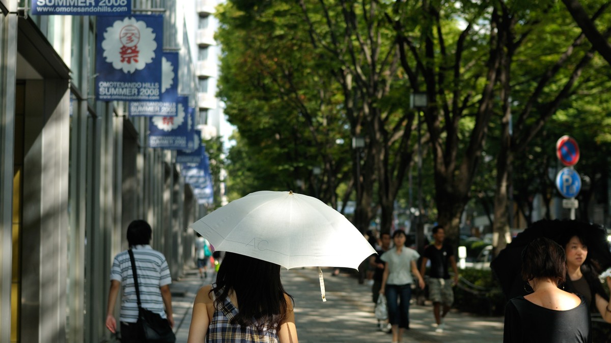
For summer travellers the hazard most likely to actually affect you is not an earthquake or a typhoon — it is heat, and Japan runs a statutory alert system for it under the amended Climate Change Adaptation Act. What follows is the Ministry of the Environment criteria and its published calls to action. No medical guidance is offered here.
| Heat Stroke Alert | Heat Stroke Special Alert | |
|---|---|---|
| Criterion | Daily maximum WBGT of 33 or above forecast at any one observation point in the forecast district, for tomorrow or today | Daily maximum WBGT of 35 or above forecast at every observation point in the prefecture, for tomorrow |
| Issued at | 17:00 the day before and 05:00 the same day | 14:00 the day before |
| Unit of issue | The 58 forecast districts nationwide (Hokkaido, Kagoshima and Okinawa subdivided) | By prefecture |
| Ministry call to action | Use air conditioning appropriately indoors and stay somewhere cool; take frequent breaks and replace fluids and salts | Everyone should keep themselves in a cool environment |
The 2026 operating period runs from Wednesday 22 April to Wednesday 21 October 2026 (Ministry of the Environment release, 14 April 2026); the general rule is the fourth Wednesday of April to the fourth Wednesday of October. The ministry heat-index site refreshes the map for today at 05:00 and for tomorrow at 14:00 and 17:00.
An opinion is defensible here, so: if your trip lands in Kansai or Kanto in July or August, put this in your morning routine ahead of the typhoon tracker. Typhoons hit a handful of days a year; a WBGT above 33 is simply what midsummer is. For which months are hot, when typhoon season runs and what to pack, see our Japan weather and what to wear guide. For what the bill looks like once you actually end up in a hospital, and whether an ambulance costs anything, see hospital costs in Japan.
Where the information comes from
One table of official channels, worth saving before you fly. The number in the first row is one most visitors never learn exists:
| Channel | What it covers | Languages / hours |
|---|---|---|
| Japan Visitor Hotline 050-3816-2787 | Operated by JNTO. Support during emergencies — accidents, illness, disasters — plus general tourist information | English, Chinese, Korean (Japanese also listed) / 24 hours, 365 days |
| Safety tips (app) | Japan Tourism Agency supervised. Push notification of earthquake early warnings, tsunami warnings and weather emergency warnings, plus an evacuation flowchart and phrases for asking for help | 15 languages including Traditional Chinese |
| JMA multilingual pages | Weather (including heavy rain and high temperatures), earthquakes, tsunami and volcanoes | 16 languages |
| JNTO Japan Safe Travel | Official accounts used during disasters | X account @JapanSafeTravel (English) and Weibo (Simplified Chinese) |
| Japan Safe Travel Information | Consolidated weather warnings and transport information during disasters | English |
| NHK WORLD-JAPAN | 24-hour English channel, providing information during major disasters | English |
| Safety Information Card | Official printed and digital reference card | English, Simplified and Traditional Chinese, Korean |
An opinion is safe here too, because this is a planning question rather than a safety instruction. Of everything in that table, only two items need doing now: save 050-3816-2787 to your contacts, and install Safety tips. The rest — the JMA multilingual pages, NHK WORLD, Japan Safe Travel — are URLs to open when you need them, requiring no preparation and certainly no additional apps. Spend the effort on the two things that work when you are disoriented, offline-adjacent and unable to read the signage.
A five-minute pre-departure checklist
- Install Safety tips, set your language, and confirm notification permissions are on. Apps get installed when you have signal and composure.
- Save 050-3816-2787 under a name you will recognise in a hurry, such as "Japan visitor hotline 24h".
- Do not assume the handset will alert you. Reception on roaming and overseas eSIMs is officially unspecified; treat Safety tips as your primary channel.
- On check-in day, look at the evacuation diagram on the back of the hotel room door, and remember the front desk is your first call in an emergency.
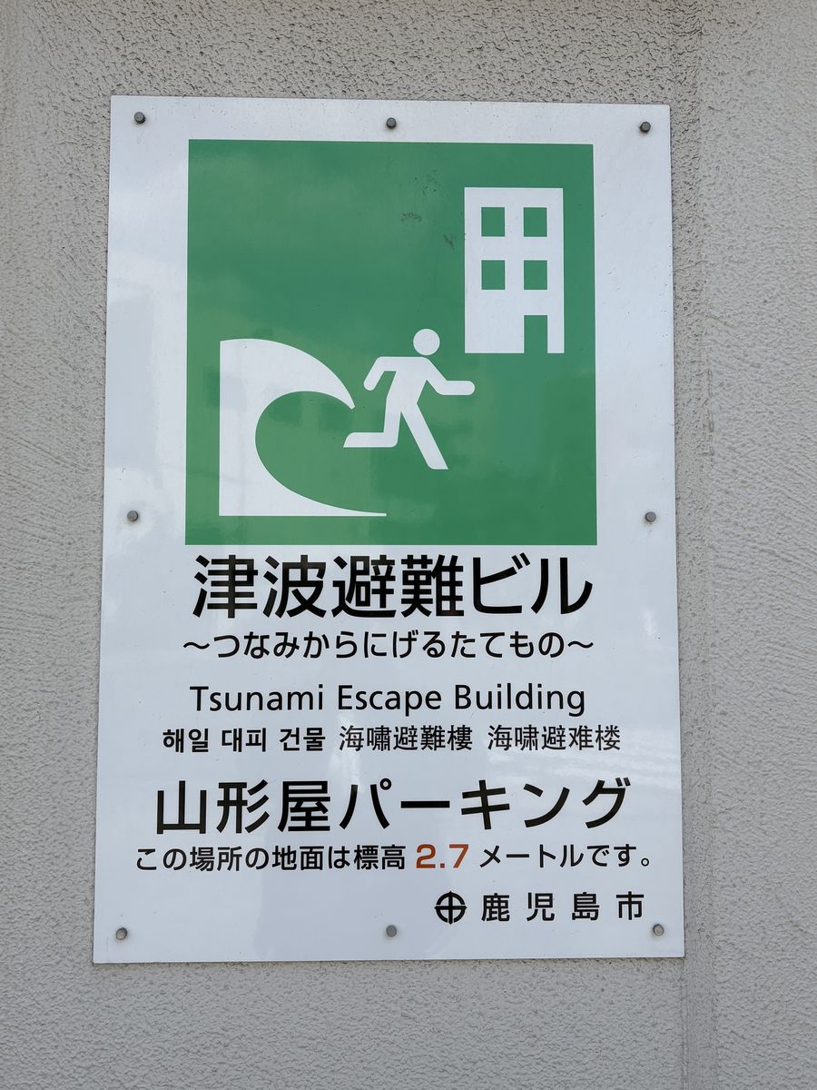
- If your itinerary touches the coast, spot the tsunami evacuation signage on arrival — blue ground, wave, running figure, arrow.
- In typhoon season, check your destination warning status and your airline notice page the day before. Carriers differ; only the official page counts.
- In July and August, check the Heat Stroke Alert each morning (today map at 05:00, tomorrow at 14:00 and 17:00).
One restatement of where this article stops, because it outranks everything above it. This is a compilation of published official material, not direction at the scene. The system changes — the most recent overhaul was 29 May 2026 — and everything here was verified against official pages on 2026-08-14. Announcements at the scene, the police and fire services, and the instructions of your accommodation always take priority over this article. Where a name or a threshold you see differs from what is written here, the official page wins. The names changed on 29 May 2026, and anything written before that date still carries the old ones.
This guide is part of our Japan trip essentials series, which covers the rest of the pre-departure work — connectivity, entry procedures, tax-free shopping and seasonal weather.
Frequently Asked Questions
- Q1:What should I do in an earthquake in Japan — get outside?
- No. The Japan Meteorological Agency publishes a location-by-location guide called "What to do when you see or hear an Earthquake Early Warning", and the home entry reads, in the original Japanese, "protect your head and take shelter somewhere safe such as under a sturdy desk" — followed immediately, in the same passage, by "do not rush outside in a panic". The widely repeated advice about running out to open ground is contradicted by that second sentence, and the two halves belong together. Inside a crowded building the guidance is to follow staff instructions and specifically not to run for the exits. One more line from the same passage tends to get dropped in translation: do not force yourself to put out a fire. Protect your body first. As for how long this lasts, the JMA FAQ says to stay alert and protect yourself "for about one minute" from the moment you see or hear the warning, and notes that strong shaking generally lasts at most about a minute. This article can only tell you what the agencies published. Announcements at the scene, police and fire instructions, and whatever your accommodation tells you always take priority over any web article, this one included.
- Q2:Will my phone get earthquake alerts in Japan if I am roaming or using a travel eSIM?
- Officially, nobody has said. This is the question this guide handles most carefully, because most English and Chinese travel content answers it with confidence that the sources do not support. The JMA page on how to receive Earthquake Early Warnings lists the five carriers that broadcast them to handsets — NTT Docomo, au, SoftBank, Y!mobile and Rakuten Mobile — and then hands the entire question of compatibility and settings to those carriers, telling readers to contact the mobile phone companies for details of supported handsets and settings. Reading that page and the JMA earthquake FAQ in full turns up nothing at all about foreign SIMs, international roaming or overseas eSIMs. Of the five carriers, Docomo is the one with clear published wording. It states that for handsets it did not sell, Area Mail has not been operationally verified and may not work, and that it cannot even answer questions about whether it works. For an unlocked Android 8.1 or later phone carrying another carrier SIM, Docomo says the specification allows the other carrier warnings to be received but that Docomo does not guarantee reception or behaviour; below Android 8.1 it says outright that reception is not possible. The other four carriers were not verified for this article, so it cites only Docomo as an example and leaves the rest to the carriers themselves. The practical conclusion: do not bet on your phone sounding by itself. Install Safety tips, the app supervised by the Japan Tourism Agency, which pushes notifications over the data network instead.
- Q3:Does buying a Japanese eSIM mean I will receive earthquake warnings?
- There is no official basis for that claim, and the reasoning behind it does not hold up. Mass-notification emergency warnings on handsets ride on a cell-broadcast mechanism (ETWS), which is a different thing from whether you happen to hold a data plan. A Ministry of Internal Affairs and Communications document from March 2024 explains that the common Android reception specification exists so that when a SIM is inserted, emergency earthquake warnings can be received on that SIM contract holder network — in other words, delivery is bound up with whether the inserted SIM and the network you are on line up. One caveat has to be stated plainly: that document is about domestic roaming between Japanese carriers, the arrangement used when one operator suffers an outage and borrows another network. It is not about international roaming and cannot be used to conclude that foreign numbers will or will not receive alerts. So the accurate statement is that officially it is unspecified, that the mechanism is tied to how SIM and network pair up, and that no official document reaches a conclusion for inbound travellers. Buy a data plan for maps, official pages and app notifications. Do not buy one expecting it to make your handset sound an alarm.
- Q4:What changed in Japan warning names in 2026, and does "Sediment Disaster Alert Information" still exist?
- It does not. A Ministry of Land, Infrastructure, Transport and Tourism press release dated 14 April 2026 announced that new disaster-prevention weather information would enter service from Friday 29 May 2026, with warning-level numbers added to the front of the information names; the switchover work began around 13:00 the previous day, 28 May. Three things changed. First, every relevant name now carries its warning level as a prefix, so what you actually see on a phone or a station display looks like "Level 3 Heavy Rain Warning" or "Level 5 Heavy Rain Emergency Warning" in Japanese. Second, a new tier called kiken keiho, or Danger Warning, was created at Level 4, with four members: Level 4 Flooding Danger Warning, Level 4 Heavy Rain Danger Warning, Level 4 Sediment Disaster Danger Warning and Level 4 Storm Surge Danger Warning. Third, a Level 5 Flooding Emergency Warning was added on the special-warning side. The consequence for readers is that the old term dosha saigai keikai joho, the sediment disaster alert information that appears in effectively every older guide, is no longer on the JMA list of current types — its role now belongs to the Level 4 Sediment Disaster Danger Warning. The Cabinet Office guideline on evacuation information was revised in March 2026 and states that aligning with this new system was one reason for the revision.
- Q5:What do warning levels 1 to 5 mean, and at which one should I act?
- The JMA publishes a correspondence table, and each level maps to one named action rather than a vague sense of severity. Level 1 is early notice information and the stated action is to raise your awareness. Level 2 corresponds to advisories (written in the new format as Level 2 Heavy Rain Advisory and so on) and to the yellow band on the JMA Kikikuru risk map; the action is to check your evacuation destination and route on a hazard map. Level 3 corresponds to warnings and the red Kikikuru band, and the action is evacuation of older adults and others needing more time. Level 4 corresponds to the newly created Danger Warnings and the purple Kikikuru band, and the action is an evacuation instruction. Level 5 corresponds to emergency warnings and the black Kikikuru band marked as disaster imminent, and the action is securing your safety by whatever means remain. One correction worth making explicitly: the old term hinan kankoku, often rendered as evacuation advisory, was abolished. Since the law took effect on 20 May 2021 it has been merged into the evacuation instruction, and the three current evacuation notices are the Level 3, Level 4 and Level 5 actions above. Any guide still telling you to move when an evacuation advisory is issued is at least five years out of date. Worth knowing too: JMA issues warnings when the qualifying phenomenon is forecast roughly three to six hours ahead, so a warning usually arrives before anything has started.
- Q6:Is a tsunami warning the same as a tsunami advisory?
- No, and the official actions differ, so the two must not be collapsed into one instruction. The JMA tsunami page defines three tiers by forecast maximum wave height. A Major Tsunami Warning is issued when the height is expected to exceed 3 metres in the highest places, with the announced height bands being over 10m, 10m and 5m. A Tsunami Warning covers heights above 1 metre and up to 3 metres, with bands of 3m and 1m. A Tsunami Advisory covers 0.2 metres up to 1 metre. For the two warning tiers the stated action is to evacuate immediately to high ground or an evacuation building. For the advisory it is to get out of the water and move away from the shore. Those are different instructions and the difference matters. Two more points are worth carrying with you. The JMA classifies the Major Tsunami Warning as an emergency warning. And the agency targets issuing the first bulletin within about three minutes of the earthquake, about two minutes for some events. For a very large earthquake the first bulletin may not give numbers at all, using the words kyodai (enormous) and takai (high) in place of a height — those words mean the agency cannot yet quantify it and the situation is serious.
- Q7:A Nankai Trough advisory has been issued. Should I cancel my trip?
- This guide can tell you what the agency asked for, and the decision stays with you. The JMA extra information system has four outcomes. Investigation Under Way is triggered by an M6.8 or larger earthquake in the monitored region, or by a significant change on strainmeters accompanied by related changes at multiple other observation points suggesting unusual slow slip on the plate boundary. Giant Earthquake Caution (keikai) is issued when an earthquake of moment magnitude 8.0 or greater is assessed as having occurred on the plate boundary within the assumed source region. Giant Earthquake Advisory (chui) covers Mw7.0 or greater within the monitored region excluding the above, or an assessment that unusual slow slip has occurred on the plate boundary. Investigation Concluded means neither applies. The agency aims to publish within about two hours at the earliest. On actions: under the caution tier, residents for whom evacuating after an earthquake might be too late are asked to evacuate in advance for one week, followed by a further week of heightened preparation such as keeping emergency supplies to hand. Under the advisory tier the ask is one week of reviewing everyday preparations plus that heightened preparation. And the sentence that deserves the most attention is the agency own: at present there is no scientifically established method for predicting the timing, location or scale of an earthquake with high confidence. After an investigation concludes, the guidance is to go about normal life while remaining alert. Statistics circulating online about the odds of a large earthquake following an advisory do not appear on the JMA pages and are not quoted here.
- Q8:Can foreign visitors use Japanese evacuation shelters?
- No positive official statement addressed to travellers was found for this article, so no claim is made either way. What does exist is a different body of documents: Japan Tourism Agency and ministry materials aimed at businesses, including initial-response manuals for accommodation providers, guidance on drawing up tourism crisis-management plans, and a glossary of plain-language disaster phrasing. Those documents oblige operators to look after visitors; they are not declarations of rights to visitors. The practical order is therefore clear — ask the place you are staying first, then follow the local authority and on-site instructions. Two Japanese terms are also worth separating, because English collapses both into "shelter". Under Article 49-4 of the Basic Act on Disaster Management, a designated emergency evacuation site is somewhere you go urgently to protect your life, and municipalities designate it separately for each hazard type: flooding, landslides and debris flows, earthquakes, tsunami, large-scale fire and so on. Under Article 49-7, a designated shelter is a facility where displaced people stay for a period, designated without reference to hazard type. A single location can be both, but they are not synonyms — a site designated as an evacuation site for earthquakes is not automatically valid for tsunami, which is exactly what the icons on the signboard are telling you.
Read next
When Your Train Is Cancelled in Japan: Refunds and Delays
A delay refunds the express surcharge only, never the base fare. But a one-hour departure delay also qualifies if you give up the trip.
Japan Travel Insurance Guide 2026: Medical, Delay & Cards
How expensive is Japanese healthcare for tourists? Travel-medical vs trip-delay vs credit-card cover, how much to insure, ski/hiking/rental-car gaps, and which receipts to keep.
Best Japan Travel Apps 2026: Maps, Transit & Translate
Which apps you actually need in Japan and which to skip — navigation and transit (Google Maps, Navitime), Suica and payments, translation with an offline Japanese pack, and food (Tabelog). The 4-5 must-haves vs the nice-to-haves.
📊 See the 2026 Price Index (JR Pass, DPA, eSIM, Airport Transport) →