Kamikochi is an alpine valley at about 1,500 m at the foot of the Northern Alps, regarded as one of Japan's most beautiful mountain landscapes. The clear Azusa River winds through it, the Hotaka ridgeline rises straight ahead from Kappabashi bridge, and with Taisho Pond's reflected dead trees and the stillness of Myojin Pond, it's almost unreal. Best of all, the valley trails are flat and easy for anyone — you reach the grandeur without mountaineering. But two key conditions apply: it's open only mid-April to mid-November, and private cars are banned year-round. This guide covers the season, the car-free access, the hiking routes and times, and gear. It's the alpine-hike deep-dive for Chubu; the gateway city is in our Matsumoto guide.
- A stunning Northern Alps valley: Kappabashi and the Hotaka peaks, flat easy trails
- Mid-April to mid-November only: 2026 is Apr 17-Nov 15, closed in winter
- Cars banned year-round: park at Sawando/Hirayu and shuttle in
- No admission: trails are free; you spend on transport and meals
- Classic route: Taisho Pond→Kappabashi 1h, Kappabashi→Myojin Pond 1h one way
📖 Table of contents
What Kamikochi is
Kamikochi lies in the mountains west of Matsumoto in Nagano, the heart of the Chubu-Sangaku National Park, protected doubly as a Special Place of Scenic Beauty and a Special Natural Monument. It's an alpine river valley carved by the Azusa River, flanked by 3,000-meter peaks like Yakedake and the Hotaka range, the valley floor at about 1,500 m — cool in summer with crisp air. Unlike a hard climb, Kamikochi's valley has flat boardwalks and gentle paths, so ordinary visitors can walk right into the scenery — its most beguiling and unusual trait.
Precisely because this nature is so strictly protected, Kamikochi is car-free year-round and open only in the snow-free season. Plan it as "an alpine hike you reach by transfer, mostly on foot," sort out the access and timing, and you can easily enjoy one of Japan's finest mountain landscapes.
A bit of history adds to the place: Kamikochi was popularized in the late 19th century by Walter Weston, a British missionary and mountaineer who championed the Japan Alps and helped introduce recreational climbing to Japan. A relief of Weston stands along the river, and the annual Weston Festival in early summer still marks his role — which is partly why this valley, rather than some equally scenic but harder-to-reach gorge, became the gateway and symbol of the Northern Alps. Knowing that, the easy boardwalks and the lodges feel less like an intrusion on the wilderness and more like a century-old tradition of letting ordinary people stand among great mountains.
The season and the best timing
Kamikochi is open only from mid-April to mid-November, closed in winter. The 2026 season runs April 17 (the Kama Tunnel opening) to the closing ceremony on November 15, with the 56th opening festival on April 27 — that festival is a ceremony, not the opening day, and you can enter from April 17 — and lodging and dining opening progressively from then. Dates for 2027 have not been announced; the full season timeline, daily access hours and winter rules are in our guide to when Kamikochi opens. Each season has its character:
- Fresh green (May-June): tender new leaves against the still-snowy Hotaka peaks, fresh and lovely.
- Summer (July-August): the cool valley floor is prime for escaping the heat and for hiking, also peak climbing season.
- Autumn foliage (early-to-mid October): the larches turn gold against the snow-capped peaks, Kamikochi at its most magical and most crowded.
Whatever the season, dawn is Kamikochi's loveliest hour — Taisho Pond's morning mist and windless reflections, the Hotaka peaks in first light, are at their most moving early. To catch them, a day trip is tough; you'll want to overnight in the valley.
The car ban and access
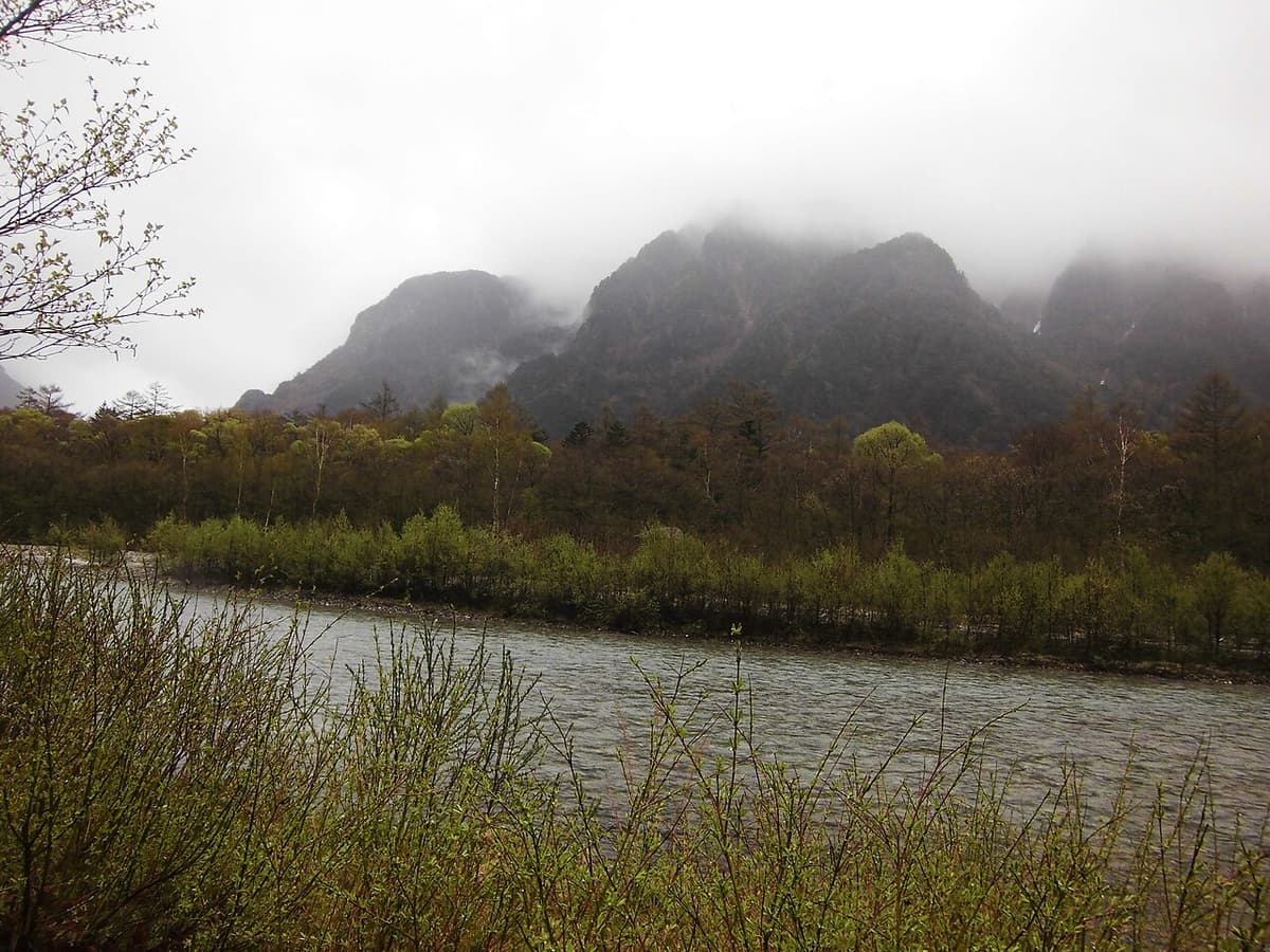
Planning Kamikochi, access is the crucial piece, because private cars are banned year-round. You can't drive into the valley — you park at a lot below and transfer to a shuttle bus or fixed-rate taxi:
- From the Matsumoto side: park at the "Sawando" lot (about 2,000 spaces) and shuttle in. Without a car, take the Matsumoto Dentetsu line from Matsumoto to Shin-Shimashima, then a bus.
- From the Takayama/Hirayu side: park at the "Akandana" lot and shuttle in. You can also bus in from Hirayu Onsen.
Access hours are about 5:00-19:00 (extended to 20:00 in July-August). You can enter from either Matsumoto or Takayama, and many plan to enter one side and exit the other, taking in both Shinshu and Hida. Fares, parking rates, last buses and the fixed-rate taxis are deliberately left out of this guide — the current figures, after the April 17, 2026 Alpico fare revision, are in our Sawando and Hirayu shuttle fare and last-bus guide. None of these tickets can be booked online — the Sawando and Hirayu shuttles, the National Park Liner direct from Matsumoto BT, the Sawayaka Shinshu-go from Shinjuku, and the Myojin Pond entry fee are absent from all four major booking platforms, so they are counter or official-channel purchases only. Don't plan around having everything ticketed before you fly. For a multi-leg Chubu rail loop, compare a JR Alpine-Takayama-Matsumoto Area Pass.
Kappabashi and the Azusa River
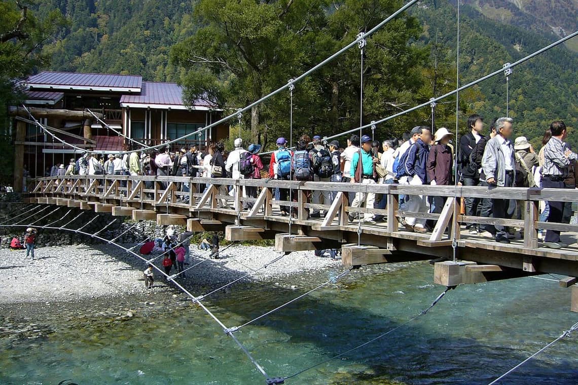
Kappabashi is the landmark and spiritual center of Kamikochi — a wooden suspension bridge over the Azusa River, and from it, looking upstream along the clear water, the majestic Hotaka ridgeline rises dead ahead, the classic must-take shot. Hotels, shops and restaurants cluster by the bridge, the valley's main hub, and most routes start or end here.
The Kappabashi area draws the densest crowds, but walk a short way up or down the Azusa and you're quickly back in quiet nature. The crystal-clear river, the primeval forest on both banks and the distant snowy peaks make even an unhurried riverside walk deeply restful.
Taisho Pond and Myojin Pond
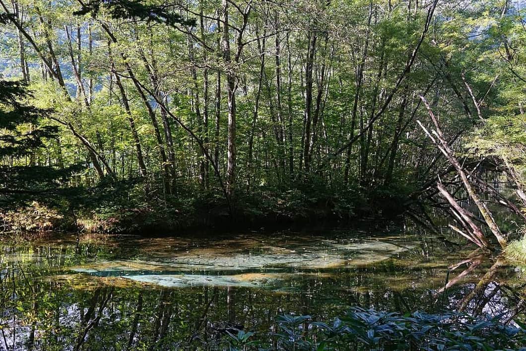
Taisho Pond is Kamikochi's other signature. It formed when the 1915 eruption of Yakedake dammed the Azusa with mudflow, and dead tree trunks still stand in the water, which with the reflected Hotaka peaks makes a still, faintly desolate picture. The dawn mist and the mirror reflection on a windless morning are the most magical, a photographer's favorite. Many alight at Taisho Pond and walk downstream toward Kappabashi — the classic beginner route.
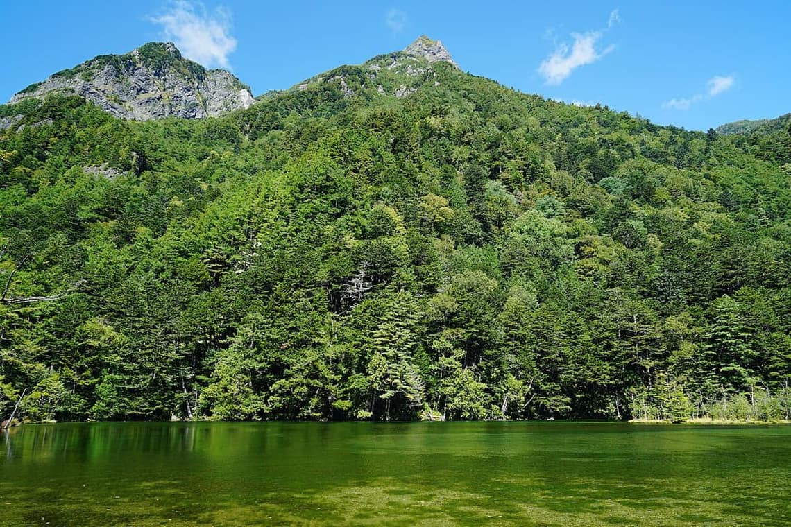
About an hour upstream from Kappabashi is Myojin Pond — a clear, tranquil mountain pond within the precincts of the Hotaka Shrine inner sanctuary, with a sacred air. Entering the pond grounds costs a fixed admission of ¥500 for adults and ¥200 for elementary-school children (open 6:00–17:00) — a set shrine price, not the "small donation" older guides describe. The Myojin area's forest is quiet with fewer people, a good choice for escaping the Kappabashi crowds and walking a little deeper.
Hiking routes and times
Beyond the headline three, a few smaller spots reward the walk between them: Tashiro Pond and the Tashiro Marsh on the Taisho-to-Kappabashi stretch are quiet, reflective and often missed; the Dakesawa Marsh just upstream of Kappabashi is a short, lovely detour; and crossing Myojin Bridge lets you loop back along the opposite bank rather than retracing your steps. None add serious difficulty, and they're how you turn a tick-the-box walk into a proper morning in the valley.
Kamikochi's main valley trail is largely flat, with boardwalks and easy paths, walkable for anyone — not mountaineering level. By time and fitness, three common plans:
- Easy half day (about 2-3 hours): alight at Taisho Pond → along the Azusa and Tashiro Pond → Kappabashi (about 80 minutes by the official figure), rest and eat near the bridge, then return.
- Classic day (about 4-5 hours): Taisho Pond → Kappabashi → Myojin Pond (about 2 hours round trip from Kappabashi), covering all three highlights.
- Advanced (half day or more): Kappabashi → Tokusawa → Yokoo (toward the Hotaka and Yari trailheads), longer and needing more time and gear, for strong walkers.
The trail has hotels, lodges and shops along the way, so supplies and toilets are convenient. To pair with other Chubu mountains, see our Tateyama-Kurobe guide, and for foliage timing our Japan autumn foliage guide. For an equally gentle walk but along a historic highway, the Nakasendo post towns in southern Nagano's Kiso valley are well worth adding — see our Kiso valley Magome-Tsumago walk.
Staying in the valley: if you want the dawn, you sleep inside Kamikochi, and there are roughly three tiers. Classic resort hotels around Kappabashi and Taisho Pond (like the Imperial Hotel and the Gosenjaku) offer comfort and a prime location at a premium; mid-range lodges and inns near Kappabashi and Myojin are simpler but well-placed; and deeper-in mountain huts toward Tokusawa suit hikers heading higher. All of these book out far ahead for the foliage and summer peaks, so reserve early once your date is set. Note that because cars are banned, you carry your own bags in from the shuttle — pack light, and bring layers for the cold mornings the day trippers never feel.
For a room inside the valley, Agoda's Kamikochi area list is the cleanest one available: the properties at the top are all located in Kamikochi, including the Gosenjaku Hotel and Shirakabaso by Kappabashi. Three things to know first. The list opens on today's date, so change it to the night you want before reading anything into it. From the November 15 closing until the mid-April reopening, every lodge in the valley is shut, so dates in that window have nothing to book — and the 2027 opening date hasn't been announced yet. And although Booking.com has a page called "Kamikochi," what it lists are inns at Nakanoyu Onsen, Hirayu and Okuhida, all outside the Kama Tunnel or over on the Gifu side — staying there means shuttling in and out every day, which is not the same thing as sleeping in the valley.
Gear and practical tips
Kamikochi is easy to walk, but it's still a high-elevation mountain area — a few tips make it safer and more comfortable:
- Warmth and rain gear: at 1,500 m even a midsummer dawn is only in the low teens Celsius, cool morning and night; mountain weather shifts fast, so bring a light jacket and rain gear (a raincoat beats an umbrella).
- Footwear: flat as it is, wear comfortable non-slip trainers or hiking shoes — some sections have roots and gravel.
- Wildlife: Asian black bears live here, so stay on the marked trails, don't feed animals, and carry your trash out; don't approach or feed the monkeys either.
- Supplies and timing: mind the last shuttle bus and don't walk too late; shops exist, but still carry water and snacks.
For what to wear by month and how to pack, see our Japan packing & weather guide.
The Kappa Bridge–Myojin flat trails carry little risk, but if you head deeper into the mountains, confirm your policy covers mountain rescue costs — see insuring hikes and rescue costs in Japan.
Frequently Asked Questions
- Q1:When is Kamikochi open?
- Kamikochi is open only from mid-April to mid-November, closed in winter. The 2026 season runs April 17 (the Kama Tunnel opening) to November 15, with the opening festival on April 27. Timing of the highlights: fresh green in May-June, cool summer hiking in July-August, autumn foliage in early-to-mid October (most magical against the snow-capped Hotaka peaks). Lodging and dining open progressively from April 17 — and note that the April 27 festival is a ceremony, not the opening day, so you can visit from April 17. In winter the road and every facility close; entry is not legally banned, but officially it counts as self-responsibility winter mountaineering rather than sightseeing. For the full season timeline, 2027 outlook and winter rules, see our Kamikochi season and access guide.
- Q2:Can I drive into Kamikochi?
- No — private cars are banned year-round at Kamikochi to protect the environment and for traffic safety. You park at a lot below and transfer to a shuttle bus or fixed-rate taxi: from the Matsumoto side, park at "Sawando"; from the Takayama side, park at "Hirayu/Akandana." Without a car, take the Matsumoto Dentetsu line from Matsumoto to Shin-Shimashima and a bus, or a bus from Takayama/Hirayu. Access hours are about 5:00-19:00 (until 20:00 in July-August), but what really sets your departure is the last bus — roughly 17:55 to Sawando and 17:30 to Hirayu. Fares, parking charges and last buses are laid out in our Kamikochi access and bus fare guide.
- Q3:Is there an admission fee? Does hiking cost anything?
- Kamikochi has no admission fee and the trails are free; your main costs are the shuttle bus/taxi in, plus food and lodging. Three small in-valley charges differ in kind and are worth separating: public toilets run on a tip system (no official price, about 100 yen customary — carry coins); Nagano's North Alps Trail Program collects a voluntary trail-maintenance donation from 500 yen per contribution; and Myojin Pond charges a fixed shrine admission of 500 yen for adults, which is a set price rather than a donation. The full cost breakdown and every transport fare are in our Kamikochi access and cost guide.
- Q4:Is the hiking hard, and how long does it take?
- The main valley trail is largely flat, with boardwalks, easy for anyone — not mountaineering level. Classic legs and one-way times, per the official trail data (excluding stops and rests): Taisho Pond → Kappabashi about 4 km and about 80 minutes (along the Azusa River and Tashiro Pond); Kappabashi → Myojin about 60 minutes one way on the right bank (about 2 hours round trip). String those two and you cover the highlights in half a day to a day. To go deeper toward Tokusawa and Yokoo (the trailheads for Hotaka and Yari) needs more time and gear.
- Q5:Is a day trip enough, or should I stay over?
- A day trip is plenty for the classic Taisho Pond, Kappabashi and Myojin Pond route, and most people do it same-day. But to catch Taisho Pond's dawn mist and still reflections, or to dodge the daytime crowds and walk farther in peace, an overnight (there are hotels and mountain lodges in the valley) is worth it — the quiet of Kamikochi at dawn and dusk is something only staying gives you. A rushed day trip is still beautiful; an overnight is the upgrade.
- Q6:Is it better to enter from Matsumoto or Takayama?
- Either works, depending on your itinerary. From the Matsumoto side: the Matsumoto Dentetsu line to Shin-Shimashima and a bus, or drive to Sawando and shuttle in — good with Matsumoto Castle and Azumino; see our Matsumoto guide. From the Takayama/Hirayu side: park at Akandana and shuttle in — good with Hida-Takayama and the Okuhida onsen; see our Hida-Takayama guide. Many enter from one side and exit the other, taking in both Shinshu and Hida.